Mountain Biking in Dupont State Forest
 Again, on the subject of mountain biking, it's easy to just get on a trail and twist and turn your way through the woods until you get to a point that a decision has to be made. Usually the decision I have to make is "how do I get back to the car from here?" Maps are a great way to keep track of where you are and where you are going when riding flat out through the mountains. The problem is, I can't keep track of where I am. It seems like every time I reach an intersection I need to get the map out and determine the direction I need to go to get the best view, to see the next water fall or to climb the highest peak in the range. This all takes time and effort to stop and get the map out of the bag and get oriented again and make the right choice of trails to take.
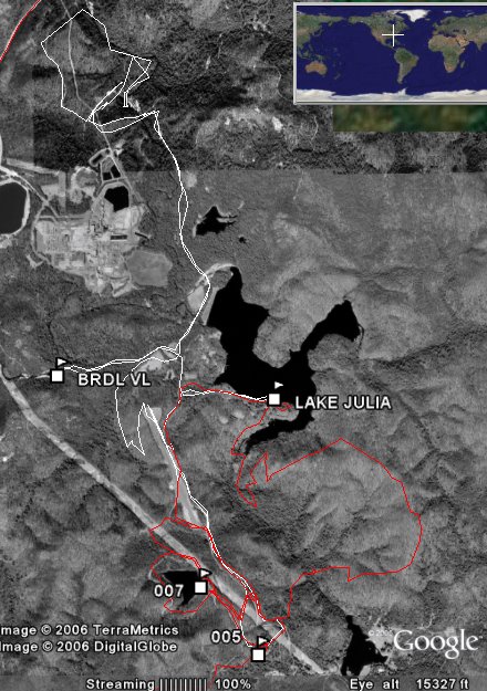
Enter the world of Dupont State Forest. Trails are everywhere and they all lead to somewhere. Remembering the turns and trail names is more than I want to attempt and still stay focused on enjoying my surroundings. Technology is the key to this problem. Kim gave me a GPS for Christmas last year and it has been sitting there looking at me since December 25th of 2005. Nothing more than en electronic map in a small hand held package it has the potential to be a little more handy than keeping up with a map. Besides.....map reading while on the trail isn't cool. The 3D view above shows actual gps data of the ride that day, it also shows gps data from the most recent ride in the same area this past weekend. The red lines indicate my line of travel for July 2nd and the white lines indicate the ride that Kim and I did on July 7th.
So armed with my new gps and a handy dandy little mount to attach it to my handle bars, I set out to see just exactly how this thing works. Not one to read instructions and spend time trying to understand all the do's and dont's of gps navigation, I put my trust in the fact that I am fairly well versed in woodsmanship and navigation.
I get to the Fawn Lake access are and get geared up for a day of riding, get the gps fired up
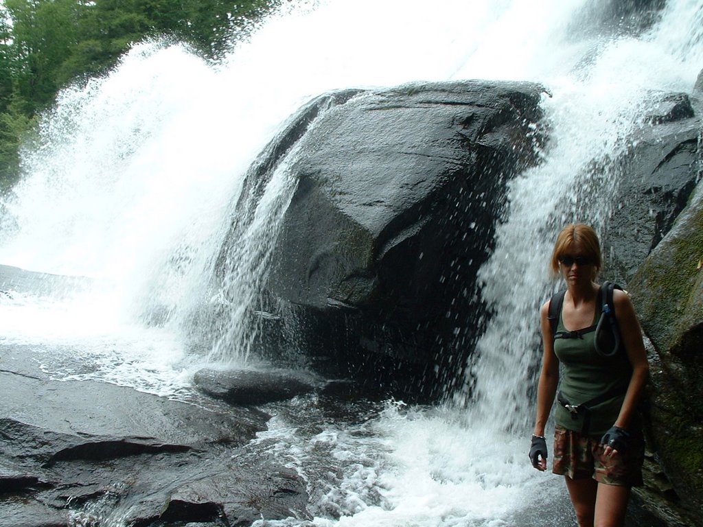 and away I go. After riding for a few miles and making random choices at all the trail intersections, I decide to stop and take a look at the gps and compare it to the map. The problem is......I forgot the map and my knowledge of gps navigation to this point consisted of putting batteries in the gps unit. This could be a desperate situation in some cases and my fear was that I would be one of those cases. So after taking the time to teach myself about basics of the gps, I felt pretty confident that I knew enough to get my way back to the parking area. I can swallow my pride later back at home and get down to the details of the instruction manual, right now I just need to know I can get back to point "A". (photo of Kim at the base of High Falls 7/7/06)
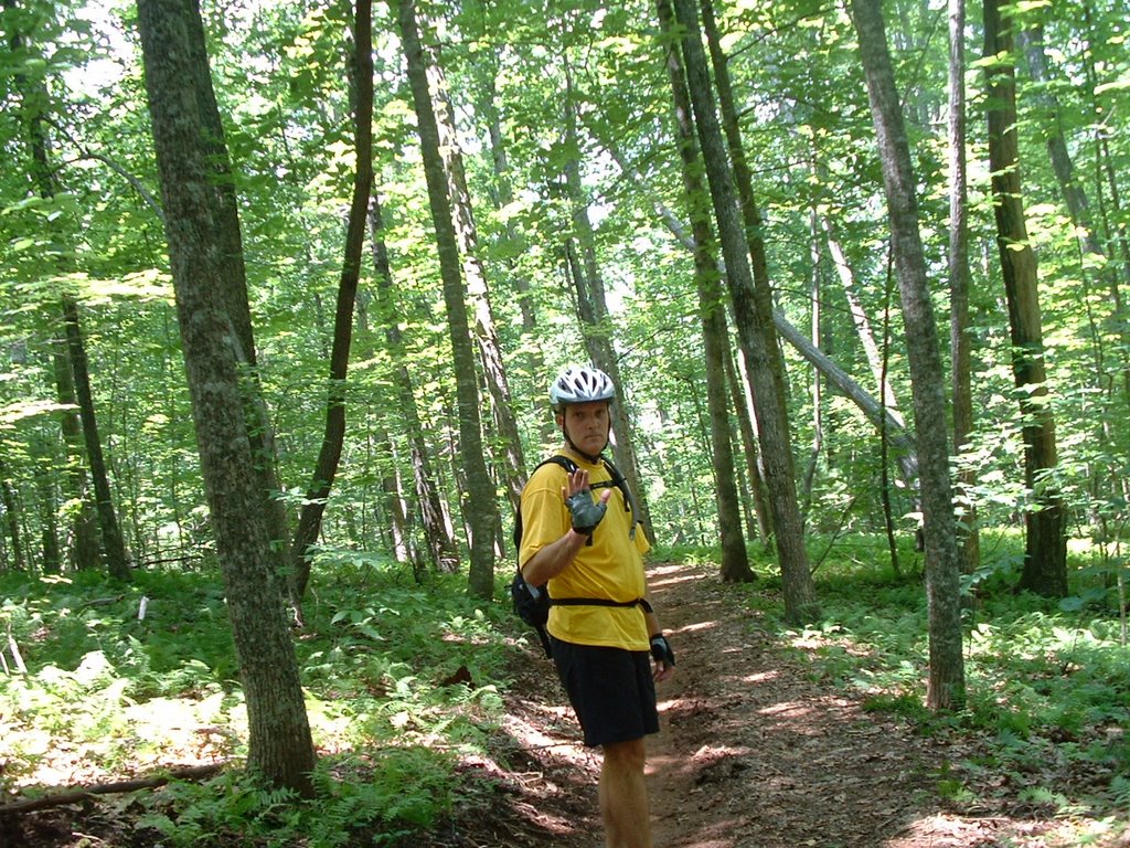 By pure dumb luck I ended up on the Reasonover Creek Trail going in the right direction for a mostly downhill ride for several miles. The trail had a couple of creek crossings that provided a chance to get cooled down a little before heading on down the mountain. Creek crossings are usually not biker friendly but these were all shallow and just right for splashing on through. (photo left of me on the Reasonover Creek Trail 7/2/06)
posted by Mark at 11:11 AM
![]()

0 Comments:
Post a Comment
<< Home